This is the third Challenge story by Jean Turner that we have published on Doodlecat, and once again it is a challenge with a theme – this time it’s the history that lies deep within the highlands
The Great Outdoors Challenge 2011
Jean Turner’s Ancient History Hike

AN ANCIENT HISTORY HIKE
Jean Turner’s 2011 TGO Challenge – Introduction

At the route-creating stage this year, I thought I was unable to start until the Monday – possibly late that day. So … how to make a fairly short and easy route interesting? I think it was the Bridge of Orchy hills map that gave birth to the idea: I noted a small building, named in gothic script denoting antiquity, “Tigh nam Bodach”. This in a pathless glen named, in normal script, “Gleann Caillaiche”. My Gaelic was sufficient to register that there appeared to be an ancient “House of the Old Man” in a “Glen of the Old Woman” … and I got googling, with intriguing results. Could I find a feasible route where there was some such antiquity for every day?
Delving into a few books on early Scottish history, I found this was more than possible, especially if I stayed fairly well south. The obvious place to start seemed to be in the vicinity of Dalriada, seat of the ancient Kings of the Scots until Scotland was united under Kenneth MacAlpin in 869 AD. Begin with the birthplace of the nation! This entailed signing out at Ardrishaig; although I normally try to find a new start-point each year, I decided to duplicate this one, as I would be following a completely different first day, with only a short crossover with my previous start from Ardnoe Point in 2007. It also meant I could entertain to dinner on the pre-Challenge evening the delightful Jack Dunagan and his wife – Jack who had sailed me in his yacht across Loch Fyne on Day 2 that year. Incidentally, he is still happy to convey any Challenger across the loch in future; indeed I think he was ever so slightly disappointed that nobody else had asked! And it was “legitimised” by Roger.
In the event, my tied-up weekend was freed; I lengthened my route by inserting two groups of Munros which were more-or-less “in my path”, and where I could camp high for two nights in each case, in the hope of skipping lightly around the peaks with a daysack, in between. Alas, the predominant weather of Challenge 2011 put paid to much of that: masochism is not my style.
Day 1
Friday 13th May – Ardrishaig to Kilmartin
This time, like most sensible Ardrishaig starters, I set off (a bit late, after last night’s socialising) up the pleasant towpath on the east side of the Crinan Canal in the rain, with one other late starter, Andy Desmond: it’s always good to have an opportunity to get to know someone whom one has really previously met only on the message board or in passing. He was to join forces with Nicola at Kinloch Rannoch later. Much of the land and roads adjoining the canal seem to be at a slightly lower level as we looked down on cars & lorries, and boggy as a result.
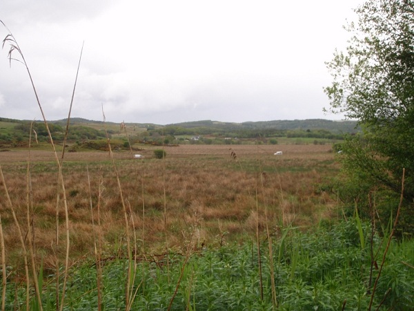
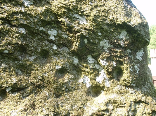
We paused for a drink and a temporary dry-out at Cairnbaan (where I had already visited prehistoric cup-and-ring marks in rocks in 2007), shortly after which our routes diverged, and I headed up the footpath to the fortress hill of Dunadd (ancient Dalriada).
The rough footpath to the summit is manageable by most people: there was an American tour group led by a clergyman the day I was there, and a couple of families with children. The weather had dried somewhat, and the view from the top is extensive, over the Moine Mhor (Great Moss); but what everyone wants to do is try a foot in the rock-hewn “footprint” in which apparently the Scottish kings had to place a foot over a millennium ago, as part of the accession ritual. Whether the fact that my booted foot fitted perfectly is of any significance seems doubtful!

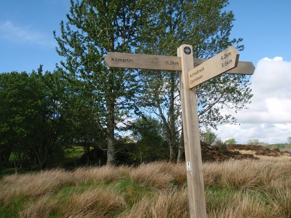
A real bonus here was that, having contacted the Kilmartin Museum in advance, I had learned that there is now a brand new footpath connecting Dunadd to Kilmartin Glen, along the south side of the meandering river to the footbridge at Tayintrath, avoiding a road-walking detour which the OS map suggests.

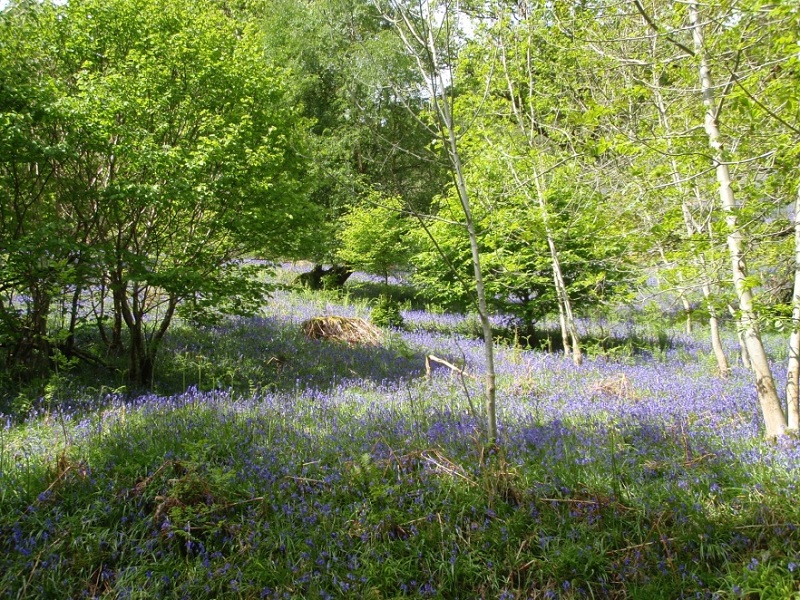
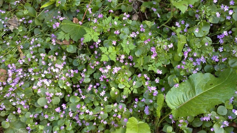
Kilmartin Glen contains literally hundreds of ancient sites, including chambered cairns, standing stones and stone circles from Neolithic times, all adorned with bluebells and pink campion, and some friendly chaffinches.


Then the next bonus: an advance enquiry to the Kilmartin Hotel about costs – in the absence of campsites on the map in a fairly populous area – had revealed that camping was allowed on the “village green” opposite the hotel, with a public toilet with drinking tap nearby. Lovely!


And of course the pub was nearby too, with excellent food.
Day 2
Saturday 14th May – Kilmartin to Loch Awe
I had allowed half a day next morning for Kilmartin village, as I knew that, in addition to its excellent Museum, it boasted a magnificent collection of Pictish symbol stones in the church and churchyard. Sure enough, I had trouble tearing myself away after a snack lunch in the museum café. The many photographs I took inside the museum cannot possibly do it justice: I cannot recommend this too strongly to anyone with an interest in the genesis of Scotland and the Scots. The Pictish Stones in and around the church are, in their way, even more impressive, some dating back to the 13th-14th centuries; one inside the church may be considerably older.


From Kilmartin, a footpath leads to Carnasserie Castle, the 16th century home of John Carsewell, Bishop of the Isles, who translated John Knox’s liturgy into Gaelic in 1567. It was captured and partly destroyed in 1685, but Historic Scotland has preserved it and one can explore it all and admire the view from its rooftops – and then picnic on a wooden bench among bluebells.

From here, a short road-walk on the B840 was inescapable, but soon the route became a minor road with some interesting farming! – and plenty of potential for camping, although too early for me.

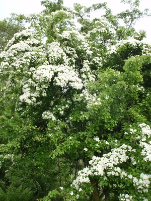
And from this, after a delightful green track from Ederline, eventually I reached the Land Rover Track cutting across to Loch Awe. Despite the deteriorating weather, there was plenty of interest: hawthorn blossom (not for nothing is it called “the May”) was out in glory as always on the Challenge, but in this damp, mild climate so were many colourful blooms.


The Lochaweside road, although prettily wooded, is something of a long trudge in the rain. It seems I could have escaped much of it, too!

However, that would have meant missing the treasures of Dunadd and Kilmartin. In view of the weather, I decided also to abandon my plan for a “shortcut” over some nearby pathless hills which I couldn’t even see, and continue up the tarmac.
It’s not easy to find a wild-camp site along this road. The few designated “picnic areas” tended to be occupied by car-camping anglers, and despite the rain, flat dry ground with water supply was rare. After experimenting with a couple of patches which turned out to be bog, I finally pitched on a carpet of bluebells … after apologising to the flowers, naturally.
Day 3
Sunday 15th May – Lochaweside to Dalmally
All the offshore crannogs marked on the map were invisible yesterday, partly because of the lush tree-cover between road and loch, but also perhaps because the water level in the loch was extraordinarily high. I hadn’t expected to access the remnants of these on Loch Awe: as far as I know, the only accessible crannog is the reconstructed “artificial island” one on Loch Tay. But I had hoped for a view of a more “natural” remnant of one of these up-to-5000-year-old Celtic loch dwellings.
I did eventually just about see one through the mist, far out from shore, today, but the nearby castle ruin was more photogenic.

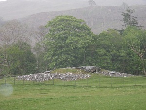
The compensation was the remnant of an ancient broch, up a side-track: this would have made better camping, and I’d have pressed on to it had I known. (There might be ghosts, I suppose??)
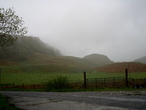
There’s even some scenery that’s improved by rain .


But I confess it was a relief to near the end of Loch Awe and head over a hillside towards Dalmally. It was also good to bump into two more Challengers, Bob Garnett and John Dingwall, on this track, although the weather was so bad that they abandoned me to my “historical” extra couple of hundred metres up to the large monument to Gaelic poet Duncan Ban MacIntyre (not ancient history, but his work involved ancient sagas and legends and the monument is worth a visit anyway).


The pair did, however, buy me a drink later, all of us having decided a night indoors was in order, so all is forgiven. The television weather forecast was not encouraging.
Day 4
Monday 16th May – Dalmally to Bridge of Orchy
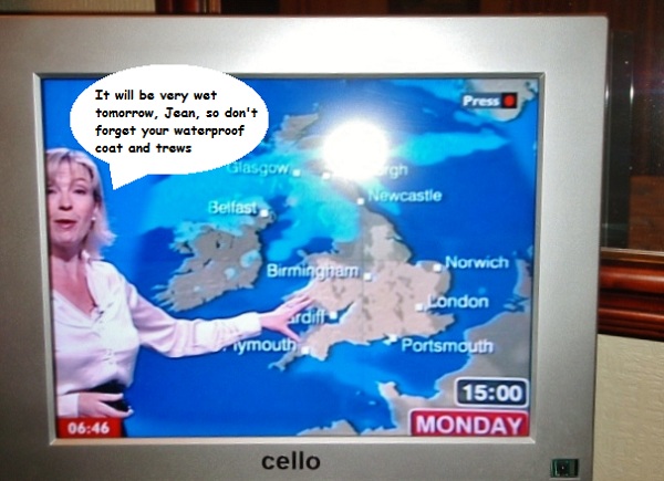
Thus forewarned by the BBC weatherlady, I decided the early saints who evangelised central Scotland were made of much sterner stuff than I, and instead of a track up Glen Strae then pathless hills heading east, the minor road through Glen Orchy beckoned. Early in the day I met two first-timers, whom I immediately admired for not having been totally deterred by the weather, despite, in one case, paying a terrible price for having forgotten his waterproof breeks! I have to confess I memorised their names (Tim & Gary) by conversion to Tom & Jerry … sorry, guys. They had the same FWA idea, and at least the waterfalls were extra-dramatic.

I planned to leave them for the last few miles, to ascend to a cycletrack running parallel to the road, high up in the forest. Fortunately we chatted to an estate worker, who told me that the track was in fact impassable due to mudslides and floods. So back to the tarmac, in the unending rain.
Bridge of Orchy Bunkhouse welcomed us all, although its drying room was a trifle overwhelmed! Plenty of Challengers here – including the indomitable Heather, who, arriving early, had decided to have a quick jaunt up Beinn Dorain with her daysack – wow. Now I felt a wimp. The rest of us were discussing alternatives to the Munros for tomorrow, and discussing the Auch Glen with Challenge Control, where Robin expressed concern about its river-crossings, with so much water everywhere.
Day 5
Tuesday 17th May – Bridge of Orchy to Loch Lyon.
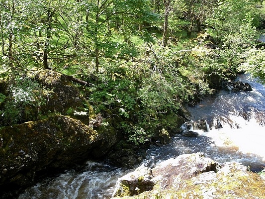
In the event, by the time we looked out after a leisurely breakfast, the twin Munros opposite were clear of cloud and the direct track up to the bealach so inviting that we headed straight up after all, avoiding the river-crossing worries. For a short time we were treated to brilliant views – before the cloud poured on to the bealach to join us. At least the pouring rain kept off for a few hours and we were able to see Beinn Mhanach (the monk’s hill, possibly named soon after St.Columba’s evangelical journeys, for his resident followers) as we descended northwards down the corrie, picking up a LRT briefly before setting off down the pathless Gleann Caillaiche.


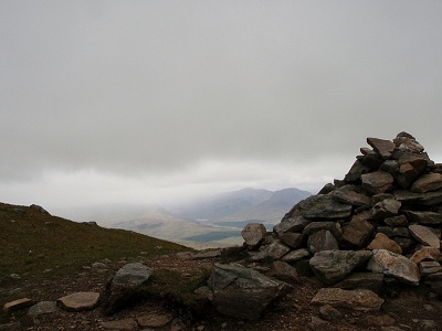

Here, I encouraged my companions to carry on ahead if they wished, as my history quest involved ensuring I didn’t miss the magical, legendary Tigh nam Bodach; but they bravely decided to stay with me, as the legend added interest to a very damp afternoon. The story goes that, in the mists of the past, a Celtic Goddess (Cailleach can mean a senior or important woman, rather than necessarily an old one, I’m told) arrived, heavily pregnant, in this glen one stormy night, with her Bodach (old man); the locals welcomed them and helped them build a shelter, where they stayed and her daughter was born, and later children also. The Goddess blessed the glen in perpetuity, provided she and her family, or at least their “relics”, were looked after properly. Those relics comprise a group of somewhat humanoid stones, living in a tiny, stone, turf-thatched house; every Beltane (1st May) someone local goes up and dusts down the figures and their home, and sets them out on the hillside to look after the herds for summer, and every Hallowe’en someone returns and tucks them up in the house again for winter. Having read that the gentleman who fulfilled this promise for decades had died in recent years, I wondered if I would find myself with the thrilling task of setting the family outside – but no, obviously the local folk still take this responsibility seriously.
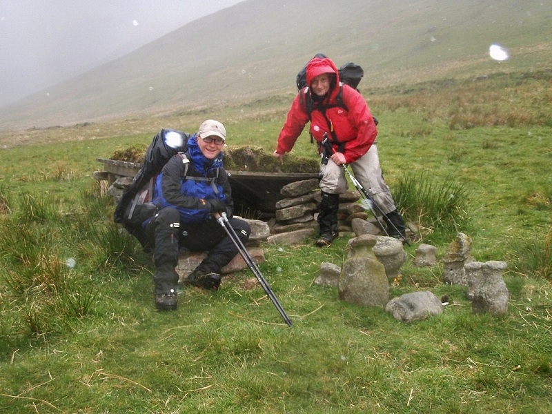
We were delighted to find this, but concerned that the new LRT which now encircles Loch Lyon has been extended up this glen, and now ends a couple of hundred yards from the Tigh nam Bodach. Surely it is time for Historic Scotland to consider some protection for such a magical place.
That same LRT led us down at last to a soggy camp above the shores of Loch Lyon. We noted one other solitary tent on a sheltered spot down a side track, and almost despaired of finding another flat patch for three of us.

Day 6
Wednesday 18th May – Loch Lyon to Milton Eonan

I was ready to go a bit earlier than the lads in the morning, and John Dingwall – he of last night’s solitary tent – happened along just in time to join me. Innocently I told all three about the web-advertised independent hostel at Bridge of Balgie, where I had booked in and sent myself a food parcel, with the blessing (by ‘phone) of the delightful but somewhat bemused-sounding elderly lady who was in charge while the young owner-couple were abroad on holiday. We all agreed it sounded an attractive option in the prevailing weather. John and I met another new Challenger – a young man also called Turner (Phil), also with a historical interest: he was following ancient drove roads, but with limited holiday was having to make a fast crossing. John was patient while I scampered up to look at the monument to 19th-century explorer and Hudson’s Bay Company trader Robert Campbell of Glen Lyon.
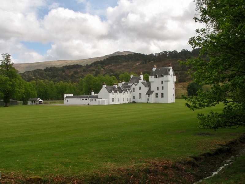
But my diversion past Gallin to investigate Meggernie Castle couldn’t compete, for him, with making a beeline for the hostel. The castle, despite being in gothic script on the map, is a well-maintained estate house, very much lived-in; but an estate manager I met confirmed that parts of it survived from its mediaeval origins. He also knew all about the ancient stones up the glen and hoped I hadn’t missed them!
This handsome building makes an interesting diversion, with wild deer grazing its lawns, and red squirrels to see along a riverside public footpath which is an attractive alternative to the road.
Glen Lyon has many places with connections to Saint Adamnan, disciple and biographer of Saint Columba, who Christianised much of this part of Scotland in the late 7th century, and in fact arranged the building of watermills in some places to assist with agriculture and employment. His Gaelic name is Eonan, hence Milton Eonan, the name of the “suburb” of Bridge of Balgie where the hostel was located. Only – it’s not a hostel any longer! That explains why no-one locally could tell me where it was; and the only possible-looking building on the map, as I followed a footpath through woodland, had children playing in the garden, and required the fording of a burn to reach it.
Eventually, after I had walked up and down beyond the hamlet, someone came along who knew: the cottage I had seen was the correct one, but was at the foot of a private road starting further up the hill, leading initially to a much larger house; and it is now a privately-let self-catering cottage for 2-4 people. However, it was indeed full of Challengers, including the trio I’d led astray, exchanging news over cups of tea! The cottage had been rented in advance by Ali and Sue, who, bless them, invited everyone in to use all the facilities, even if they had to pitch tents on the grass outside. They had been told I might be coming next day, as marked on my parcel, but I was a day early having missed the extra night high-camping in the Bridge of Orchy hills. Perhaps to make up for my missing out on the hostel, the girls invited me to put my mat and sleeping bag on a spare patch of floor, which was greatly appreciated. By late evening, this site had all the appearances of a Challenge stopover, with a mushroom growth of small tents on the grass adjacent to the cottage.

Day 7
Thursday 19th May – Milton Eonan to near Invervar.
The original plan after Bridge of Balgie was another two-night hill-romp: get up into the Ben Lawers range, pitch high up, and again spend a day stravaiging unencumbered around peaks. The morning dawned reasonably bright, but the forecast was again discouraging, including high winds; and after Sue and Ali’s tale of a sleepless night’s high-camp two nights earlier, hanging on to their tents to avoid losing them to the gale, I felt pretty dubious. However, I decided to head up the pass-road towards Loch Tay and play it by ear. When I first left the road at the top of the pass it didn’t look too promising.


Ali and Sue had, I think, already headed up there; I hadn’t suggested joining them as I was sure I would hold them up. Instead, after a “recce” towards Meall Corranaich to meet the clouds, I chickened out and decided to make my way across to the head of the LRT by the Allt Gleann Da-Eig and descend back to the south side of Glen Lyon. However, I was tempted by improving skies to deposit my large pack under a rock on the grassy shoulder of Meall a’Choire Leith and make a swift beeline for the top, where I met a couple of non-Challenge Munro-baggers from Cheshire. The weather rewarded me by holding out long enough for some superb views on my one solitary Munro.


As I descended, inadvertently scaring a mountain hare on the way, the wind rose. Even in my sheltered camping-spot further east, I was aware that the night became wild as well as wet. Still, a rainbow before sleep seemed a good omen, as perhaps did a skein of wild geese passing overhead? Perhaps I could cut south across-country and still do Meall Garbh and Meall Greigh tomorrow?

Day 8
Friday 20th – S.Glen Lyon to Aberfeldy.
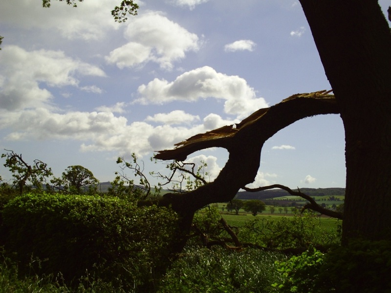
What a difference a night makes!

Same view, early morning from the tent, but not very welcoming!
Wild deer were down on the path. However, it did brighten a bit, and before crossing the River Lyon at Invervar (west of which I noted several camping possibilities), I considered heading south from Dericambus. That track was blocked by a large herd of free-roaming cattle with many young, a situation which always makes me nervous. I then went up a little ridge towards Creag Dhubh to see if there was a way over from there. Certainly it would have been possible, but it seemed quite a long rough route, the weather was far from settled, there was already snow on the tops and I had no winter equipment (although that last probably wouldn’t have mattered, as I heard later that the snow was very soft and wet). Still, when I look back at my photos now, I wonder why I didn’t: it’s really not too bad and the views back along Glen Lyon were promising.


Perhaps I was demoralised by the weather, or perhaps I was being a wimp. I wish I had gone, and salvaged a few more of my Munro plans. On the other hand … the weather was still playing games.
Rain doesn’t deter the wildlife: 3 male pheasants squabbled to court one female in a field close by, and elsewhere two hares were fighting.
In any case, I retreated to the road on the north of the river, and tried to identify Macgregor’s Leap: why are these historic sites not signed in any way? Perhaps because “they” would then need to provide parking space on roads which are already barely adequate for tourist traffic.

Wherever – I hope the river was lower than this when he leapt to freedom.
And so back to really ancient history: the Fortingall Yew, which still sprouts new life each year from its 5000-year-old roots. The earliest Christians built their 7th century church beside it, and it remains in the churchyard of the present building. Birds were still fluttering around its fresh green growth.

Happily, next door to the church is the delightful village pub where I had an excellent snack lunch. And having heard from locals there that a beautiful footpath now exists all the way from the Kenmore minor road turn-off to Aberfeldy, I decided, instead of cutting over the hill to Kenmore, to treat myself to this and try to find a B&B in which I could get properly clean and dry. The path was indeed a joy, wandering softly along the riverbank in a profusion of sweetly perfumed wildflowers and birdsong, with wild duck on the deep, swift, silent river. And for future Challenge reference – another signpost seemed to indicate a continuation westwards to Kenmore.


A local dog-walking lady recommended a B&B; it was fully booked, but the hostess referred me to her friend a few doors away – a retired American lady who planned soon to re-emigrate to the US but in the meantime was happy to help out and made me more than welcome.(Even a BATH!!)
Day 9
Saturday 21st May – Aberfeldy to Dunkeld
My B&B hostess cautioned me that a windfarm was under construction between today’s start and finish towns, and might interfere with my route; but I had little choice but to try it and see, as Allan (my better half) had arranged to drive up to Dunkeld for the evening to meet me, the town being only an hour from our home.
A few miles of road are unavoidable, even if one took the shortcut path on the old General Wade Road – but thus missing the famous Birks of Aberfeldy. Yet the sun was shining, I was heading out with everything DRY! – and the road was green and flowery and not impossibly busy.


After Loch na Creige, when I turned to the landrover track at Griffin Forest, I was immediately faced with large gates and a “No through footpath to Dunkeld” sign – plus several large timber lorries converging on the parking area by the gates. But there was a charming young Australian man in charge of operations, and when I showed him on my map that I had actually planned to leave the LRT at 952433, he told me I should still be able to get through that way, although emphasising he hadn’t officially said so … and he warned me I would see some work. No more road: what a relief.
Most of the LRT was fine and peaceful, with just a short stretch of nearby major construction before I reached my turn-off.


Not much of a path at first, but it became clearer, eventually passing between ancient stone walls as it approached the very green and fertile land around Salachill, a sad, ruined community of three groups of houses and one higher cottage.
It appeared to have been a lovely place to live, once upon a time – and yet “salach” in Gaelic means “dirty”: I wonder what the history of that is? (My personal Gaelic authority, aka spouse, tells me it could be a misspelling by mappers of “seileach”, willow; not knowing that at the time, I didn’t check for a preponderance of willow in the nearby woods.) After that, as the rain restarted, a very muddy track (salach?) led through two very rusty gates and beside the river to the ford and beyond; only after the bridge over to a farm did it become a fine easy walk, and ultimately a small road, leading past a very old cemetery to the start of the footpath which eventually traverses the woods to “Ossian’s Cave” and the Hermitage, where Allan found me.


As Roger advised, the cave and associated named spots have little to do with Ossian, who was probably a mythical creation of 19th-century Scottish Romantics – but sometimes it’s fine to dream.

We had a civilised “high tea” in a café in Dunkeld, then visited the campsite so that I could pitch my tent in the now-pouring rain; then back to the Taybank Bar (a wonderful hostelry with a continuing tradition of live music) for a drink, before Allan headed home and I to my tent. The tent area was close to the river: I did hope it wouldn’t burst its banks in the night, as I heard the hammering rain.
Day 10
Sunday 22nd May – Dunkeld to Caputh.
To my relief, there was nothing more serious than squelchy ground and puddles when I awoke, and dry intervals allowed me to dry off the tent a bit before departure. Of course I then had to walk back up to the Hermitage, to fill in the bit missed last night, before proceeding along the pleasant woodland footpath into Dunkeld, where I caught most of the morning service at the Cathedral. The Beadle (Church Officer, for non-Scots) was a mine of information on local history: not only did I see the “parent larches” (which were imported by the local aristocracy and became the progenitors of much woodland in the area), but I followed a footpath to a mound which featured in the Battle of Dunkeld (1689, Jacobite supporters of the deposed James II & VII), and which also had remains of an old ice-house for preservation of meat.


Time for a snatch of “urban Life”: a visit to the bank’s hole-in-the-wall, a 1:25.000 map (my old Landranger was ancient), a soup-and-sandwich lunch. Then the riverside path through Birnam wood, with some more ancient botanical and literary history in the “young pretender” Birnam Sycamore, and then the famous Birnam Oak.


The survival of this ancient woodland may reflect the relatively privileged climate and fertile soil of the area: I noticed also that the bluebells, pink campion, cow parsley and poppies all seemed twice as tall as elsewhere. A fallen leaf was duly pocketed from Birnam Wood, for tomorrow …

Roger’s comment that the Beatrix Potter Garden in Birnam village was “worth 10 minutes” tempted me in there; the sun was still shining at this point, and it was lovely.


Local walkers with whom I had chatted in the woods had warned, when I voiced my intention of perhaps dumping my ‘sack for a quick romp up Birnam Hill rather than a traverse, that there was a not-particularly-friendly tinker encampment near the junction of road and hill-track. I reckoned this wouldn’t be a problem, as I usually give everyone a friendly greeting and get smiles in return. But I have to admit that, as I passed and greeted some of them sitting outside close to the main road, I didn’t feel at all welcome. Perhaps I didn’t try hard enough … but I decided to leave the hilltop for another day. (I’d be interested in other Challengers’ experience: previously I’d always found tinkers friendly and ready to chat.) Disappointing, as I think it would have an excellent view. Instead I took the minor road (cycle route) south, leaving it soon for Byres of Murthly, then the unsurfaced road through Murthly Castle estate, which was an exceedingly pleasant walk on a still-pleasant afternoon.


Near the far end, I met a friendly couple walking their dogs – I wondered if they might be the owners of the castle and estate; they directed me down a very useful, inconspicuous and unmarked path which was a shortcut to Caputh Bridge, and told me they had heard glowing accounts of the independent hostel at Wester Caputh. I knew of it, since a friend of mine used to run it. I had intended to proceed east from Caputh to Inchtuthil that evening, but the temptation to stay overwhelmed me. The hostel was indeed delightful, but it was still early; I booked in, deposited my bag, and after studying the map headed out to explore the Roman Fortress that evening, which would allow me to cross the Tay here again in the morning, avoiding the long road walk which would ensue if I continued east from Inchtuthil.
There may not be a huge amount to see on the hill that is the fortress, but it’s well worth a visit: I was told by the hostel people to look out for the trenches where the legionnaires would have fought to guard it. Apparently square-profile iron Roman nails are still frequently found or dug up here, but a fair bit of burrowing among the lush undergrowth yielded none for me! Also a possible “healing well” from the past could not be identified where mapped. But the high-level footpath around the larger part of the fortress provided inspiring views, especially high above the water.


Do I really have to admit to yet more cowardice here?? Well, I suppose imagining it might make you smile … My planned circular route went diagonally all the way across the extensive high open plateau that was the main fortress area, and back along the river. But before I reached half-way, I saw that my exit gate was blocked by a very large flock of cattle with young, through the midst of which I would have to walk, with no other humans for miles. Ho-hum – turn back the way you came, Jean. Walking calmly, I looked over my shoulder – and realised the animals had got wind of me and were all heading my way. Ouch – if they were hoping for extra food they’d be disappointed. As I quickened my walk, I heard a rumble: they were now galloping my way. Ahead, to one side, was a fenced field – get in there quick, I told myself. Nearly there – and there’s an electric wire just in front of the fence. Never, I suspect, in the history of the Challenge, were such efficient high-kicks done with a large pack, for a no-touch-technique crossing. From the other side, I could turn, grinning, and gloat at them … poor things, they were probably harmless!

So back to Wester Caputh, which is a great year-round venue (weekends only in winter) for groups, and particularly music groups. The entire 17-bed hostel can be hired for £290 a night, I gather, and an additional self-contained house for 8, although I’m not sure if that’s part of the deal.
And guess what?? I’d had most of a day with NO WATERPROOFS!!
Day 11
Monday 23rd May – Caputh to Burrelton.
Pouring rain … So glad I saw the Roman Fortress last night, in evening sunlight. And strong gales with yet more rain forecast. Having waited until 10 for it to ease, I left anyway – and it did ease quite soon, for a time. The minor road to Kinclaven was quiet, and a slight digression to the north showed an attractive village with a very large church. Again I began wondering about names: “Kin” usually comes from the Gaelic “Ceann” meaning head, and is usually quite obviously at the head of a loch or glen. There’s a wee wooded glen here, but nearby across the Tay is a mile-long “cleaven dyke”, an earthwork apparently thousands of years old, which made me wonder about possible ancient extensions towards the river, or a similar structure here. I haven’t resolved that one, yet. The gale was beginning, accompanied by showers, and I had a long day planned; I went to look at the famous Beech Hedge of Meikleour, but not north beyond that to the Cleaven Dyke.

However, I have been back since then, and the lovely footpath alongside the dyke, or indeed the green LRT cutting across it, would make excellent Challenge routes, NW-SE or SW-NE, with passable access to minor roads all sides.

But for now, I turned south again, the couple of miles of A-road walking made more scary by the buffeting wind, which was strengthening by the hour. After I turned left on the minor road to Collace, the main concern was of being struck by a fallen tree or major branch: these now littered all roads, rendering many impassable to cars (Roads Departments being fully occupied with main roads), although I could generally clamber over or around. Interestingly, the vast majority of large broken branches in this area were oak: is the legendary strength of the oak rooted in its rigidity, so that it cannot bend to the wind? A minor risk was of slipping from walking on oak-apples!
As I headed for Collace, I was aware of an incoming call on my mobile – a new experience after many signal-less days. There was no prospect of hearing anything in the now-lashing rain and raging wind; but just ahead was a small house-building site, with a static-caravan “site office” into which I intruded when my knock went unanswered. Having checked and responded to the phone call (from home, checking I was okay), I went in search of my “hosts”, who were just about to give up for the day after risking their lives trying to work on roofs! They were happy for me to eat my snack lunch in the caravan, which was very much appreciated. All vegetation now showed a list to port.

Ah well, press on south-east, through Collace, to the path leading up Dunsinane Hill, at the foot of which is an information board. Intriguing that its original and local name is “Dunsinnan”, with the emphasis on the second syllable: a glance back at the board in Birnam Wood shows that, in that first quote from the apparition in “Macbeth”, the name does indeed scan that way, although in all subsequent mentions, the stress is on the final “-ane”. I started up the gentle path … gentleness notwithstanding, the wind was now such that I couldn’t stay upright 50 metres up, so no way was I going to the top, even of a tiny hill. The token leaf from Birnam Wood was duly deposited at Dunsinane – in a gorse bush, to encourage it to stay there for at least a few minutes before blowing back to Birnam!


Again, I’ve been back since, and the views are splendid, and my original plan to ridge-walk the adjacent hills eastward would in fact have “gone” very well.

For today, back down to the tree-littered roads, turning north up the A94, with a view now to booking into the first reasonably-priced cover I could find. This turned out to be the Park Inn in Burrelton, where they gave me a discount for not requiring breakfast (I had intended far more camping and was well supplied with the usual Stoats Porridge Bars), and a further discount before I left – despite my having over-used their facilities to get everything dry again.
Day 12
Tuesday 24th May – Burrelton to Glamis.
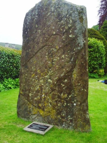
Signs of yesterday’s storms were everywhere, and tree-removing operations continued on some roads, but at least the weather had calmed down, as I road-bashed to Coupar Angus, and thence on a narrow, unclassified road through Ardler to Meigle. I think it was on this very open, wide-viewed road, with minimal traffic, that I decided at one point that the high hedges were enough to conceal me if I went just a few yards off the road for the usual reasons, to a spot behind an inadequate tree … only to find, of all things, a double-decker bus approaching! I hope all on the top deck were admiring the view on the other side. Further along this road, there was the opportunity to take in “Macbeth’s Stone” (a cup-and-ring-marked ancient stone, according to legend the site of his last stand), at the entrance to Belmont Castle, a Church of Scotland care home centred on a 15th century tower house which was the residence of the Bishops of Dunkeld.
Roger had assured me the Pictish Museum in Meigle was “a wee gem” … very true.

A bit bloodthirsty in places, perhaps – but not enough to put me off lunch in Roger’s other “wee gem” – the Old Joinery Coffee Shop!
The route from here had been south to Newtyle and beyond, to ascend via Henderston and look for the mapped St.Anthony’s Well, before traversing this part of the Sidlaws to descend through Wester Denoon. But, finding myself reluctant to plod along a few miles of B-road, I walked east for a kilometre to a much smaller and shorter road, which looked as if it would give me access to the Tower on Kinpurney Hill, from which I could leave out the Well if necessary, and go east as planned.
The first promising-looking attempt was thwarted, although I did go further up to see if there might be just a fence I could climb over without damage, before the House:


Frustrated and somewhat weary by now, and worried that my exit east might be similarly blocked, I settled for the rather pretty minor road east towards Glamis Village.
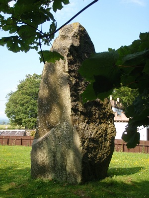
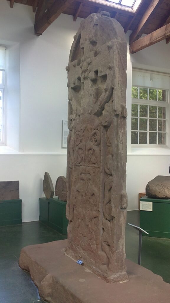
The adjacent Glamis Castle I had visited on a previous Challenge; this time I was aiming for a particularly fine Pictish Standing Stone in the garden of the Old Manse.
The village looked pretty well-heeled, with a scarcity of potential camp-spots; although really wanting to camp, I did enquire at a local hostelry about the cost of B&B: £55!! Can’t do that. Anyway, I proceeded to the handsome old manse beside the still-functioning Kirk, and over the iron gates noted someone in gardening clothes, tidying up the extensive storm damage. Thinking he might be the Minister’s gardener, I went to the gate to chat, and to enquire about the Stone.
The Kirk, of course, had sold this manse, as it has been forced to do with so many others: this was the new owner. He had a son working in the theatrical world, as is my daughter, and we chatted happily about this, and about his social-worker wife due in soon from work in Dundee, before I told him about my hike. I was then cheeky enough to ask if there was any chance I could put my tent in a very inconspicuous, tree-shaded corner of his large garden; but he was worried about further branches falling on me, and suggested I pitch on the flat grass by the standing stone instead! I offered to help with the garden clear-up in return, which he appreciated as he has serious back problems. His wife was equally helpful, and arranged for me to have access to a toilet and washroom night and morning; she has a magical way with animals, and has a menagerie of rescued fauna (including two owls) living happily in large enclosures behind the house. The only concern was that I had to be carefully introduced to their three large guard dogs during their evening walk – certainly I wouldn’t have liked to be on the receiving end of the dogs’ guard duties.
The Stone, of course, was magnificent: WHAT a place to camp! Like so many, it has a “pre-Christian” pagan side, and a “Christian” side … the Picts may have been economically re-using old stones – or may just have been hedging their bets! In the absence of any decipherable written records, we shall probably never know. But I thought it perhaps wiser to pitch on the Christian side, and I’m glad to report that nothing went bump in the night.


Lots of nearby historical interest, and copious flowers, for an evening stroll down the wooded glen.
Day 13
Wednesday 25th May – Glamis to Lunan Bay.
The area around Forfar is notorious among Challengers for absence of off-road routes, and I was somewhat dreading this morning. But a couple of locals told me the main A road to Forfar had a footpath or cycle-path virtually all the way, and a broad flat grass verge otherwise, and this proved an efficient and painless way of reaching Forfar, where the Library staff were very helpful with local information for my onward route. It was a bit early for lunch … but history demanded I eat a Forfar bridie! (Nearly lunchtime as I write, and I’m salivating at the memory).

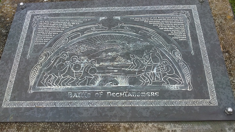
There’s a choice of minor roads, LRTs and bits of footpath to get from Forfar to Dunnichen Hill, including one (which I didn’t use on this occasion) with a short digression to the Monument at Hillside. The route through Auchterforfar is good – what a wonderful name. Dunnichen Hill and the land between it and Dunnichen village is thought to be the site of the Pictish Battle of Nechtansmere – the one which saved us all from the dreadful fate of becoming Northumbrians and therefore eventually English!!
In the village, there are various reminders of history, on a roadside cairn and around the Church.


Then the OS-mapped footpath to Letham is green, inviting, and well-maintained, with further historical information.


After such an early lunch – and so much history – I was ready for a good afternoon tea, which I found in the Hamelt Tearoom in Letham. “Hamelt”, I’m told, is old Scots for “home-grown”, and there was certainly lovely home-made soup and bread. I noticed they also sold those excellent oatcakes made in my home village of Portsoy on the Moray Firth coast, by John Donald the baker, who was in my class in primary school!
Thus fortified, and having changed my boots (now hurting one big toe) for sandals, for greater speed on all the road-walking ahead, I decided to press on as near the coast as I could get before dark, instead of stopping at Friockheim. The very minor road eastward by Fallady Bank, Gardyne Castle and West Muirhouse, to Leysmill and thence to Chapelton and Inverkeilor, was all very pleasant but seemed completely lacking in camping opportunities – although I guess I’d have found one by a farm, if desperate; on such a sunny evening, I just kept walking. By Inverkeilor it was getting pretty late, but the pub had only one room which was taken, and no-one could tell me of anywhere to camp except down at the (unmapped) campsite at the north end of Lunan Bay.

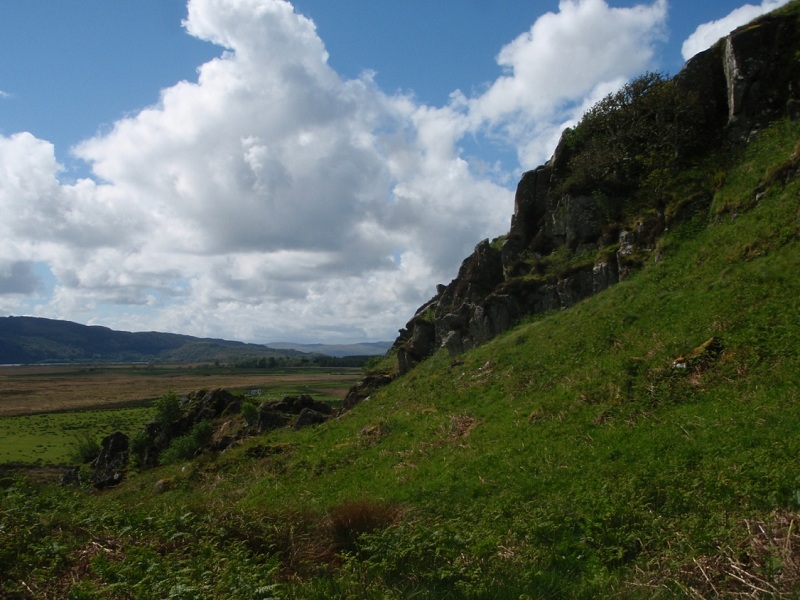
I headed there through failing light, not daring to take time for a close-up look at the dramatic ruin of Redcastle (above – another for return visit), only to be told by a local walker that the campsite owner, whose permission I needed, lived some distance back up towards the main road. There was no marker for the site, and no other tents to be seen, at least not in the now gathering gloom.
Might as well get past the dunes on to the beach and dip my toes … then at least I’ve finished, even if with a bit of anti-climax!

However, then my luck changed: two schoolgirls to whom I’d chatted on the beach were about to be picked up by the mother of one of them, in the rough parking area. Rather hesitantly, I requested a lift back to the main road as it was getting so dark; she very kindly agreed, then when she heard, in the car, where I was going, she announced her route home took her past the Montrose camp site and she would drop me there: bless her. Even as I pitched hastily while I could still see, I was made more than welcome by other Challengers already there, and could enjoy very late supper, and the thought of a conscience-free lie-in before reporting to the Park Hotel in the morning.
Appendix
The Challenge is all about wilderness, hills and self-sufficiency, and thus tends to become a measure of one’s resilience. But does that have to mean physical toughness, pushing on up and over mountains in the foulest of weather? Obviously not, or the organisers would not recommend – even demand – foul-weather alternative routes. Sometimes such FWA routes can seem pretty dull, viewed simply as an unfortunate necessity, amid disappointment at missing out on the high places. And I admit I sometimes felt a bit of a wimp on the 2011 Challenge. I ought to be used to Scots weather by now! Well yes, I am, and I can cope with most of it, but I’m getting old and no longer feel I have to rub my own nose in it, when enjoying a holiday.
This year, my entire route was initially designed as a lower and less ambitious version, because of apparent time constraints at the time, and therefore I had given it much more thought than the usual FWA. My higher hills were a later “add-in”, and although I’d have loved to have the weather to enjoy them, I didn’t feel their loss so acutely as in past years. Even when walking in the rain, I had daily “next points of historical interest” to keep me stimulated, and felt fortunate compared to others, because of this. (It also afforded me plenty of trudging-time to compose my “Ode to Roger” for the Montrose festivities.) I found several good off-road walks in the eastern part of Challenge territory, an area often neglected by many because of its lack of mountains. This is Highland Scotland, too … and has been for a very long time, with plenty of evidence to show for it.
Yes, we all love our hills, but I hope this story of some not-uninteresting “alternative Scotland” may inspire a few more Challengers to sample a varied diet after the wilder parts of the west. Or even to visit Scotland apart from (or before) the Challenge: Kilmartin Hotel, for instance, has comfortable and fairly inexpensive double rooms, and excellent food, and if there’s any love of history in your soul, you could almost never have too long in this area. (Apologies for getting a bit off-message there – but I felt I’d had a new experience this year, and I really enjoyed it).
It’s obvious that all the historical sites added to my enjoyment of the walk. But in a strange way, the fact that I was walking also enhanced my enjoyment of those sites – perhaps because it echoed the way our forebears would have travelled around and between them.
Jean Turner (Challenger No.323)