FROM SAILOR’S GRAVE TO SHIPPING FORECAST
(or, Greater Glens and Lesser Lairigs)

Scroll down to start, or follow the links below
Challenge Diary 2007
Introduction
Roger Boston had “done” my next idea, with knobs on, in 2006: not only Ardnamurchan to Peterhead (i.e. as long-distance as possible), but also incorporating all the 4000-ft. peaks. I know it’s not a competition, but my competitive streak must be lurking somewhere, because while celebrating his achievement I was also admitting that the gilt was thoroughly scraped off my gingerbread. I’d done my “high” route, there went my “long” route…. so, what to do next?
I got out my trusty tape-measure to check if, as the proverbial crow flies, that really was the longest, and found it a close-drawn match with the distance from farthest south-west point possible to farthest north-east, and furthermore that the latter line passed through some areas of Scotland of which I knew little or nothing. As something of a ridge-addict (in general geographical terms, not necessarily knife-edges), I also noted some interesting-looking pathless ridges on smaller hills. Thus was born this year’s route plan.
Challenge Eve
Thursday 10th May
My husband Allan (known to some from last year’s Challenge) had decided to come and walk the first half-day with me; since he does not enjoy camping, I web-sought an inexpensive B&B around Crinan, which turned out to be a generally highly-expensive village.
On the off-chance, I rang the sign-out hotel in Ardrishaig, to find the Grey Gull Inn being managed by one Murdo Macleod, a Gaelic-speaking schoolmate of Allan’s elder brother: they had a Gaelic chat, and we were offered the room with the four-poster. Another old schoolmate of Allan’s, now a minister in a Loch Fyneside parish, had organised help for me (of which more anon.), and he and his wife joined us there for dinner, the three men enjoying a great Gaelic gossip. I was delighted to find several other Challengers, including my old friends Howard and Doug from 2005, and was sorely tempted to swap in the morning to their route up the canal and into the forest. The above-mentioned Murdo helped me resist, by offering a lift to Crinan in the morning so that Allan would not have the problem of where to leave his car.
We also all watched BBC2’s Gaelic broadcast that evening: an episode of the Tir is Teanga (Land and Language) hillwalking series where the meaning and history of Gaelic hill and place names are discussed, Allan having found himself “volunteered” as one of their guest walkers as a result of last year’s Challenge. (It’s an excellent series for hillgoers, by the way – and has English subtitles!)
Day 1
Friday 11th May – Ardnoe Point to Loch Glashan

Off at last, in Murdo’s car to Crinan, whence I was about to walk west for a mile, in order to walk back in from my extreme-southwest start at Ardnoe Point. Intrigued by the bald word “Grave” on the OS map, at the extreme headland, with apparently an intermittent footpath to it, I was at first astonished by the clear, wide track – until I realised this was part of a new system of “forest walks”, heading uphill to a viewpoint, while my route plunged into lush undergrowth and trees, and was hard to identify in places.
Boggy, mossy and reedy, it was nonetheless undoubtedly there, with even the occasional trace of footfall; it was also adorned with bluebell, pink and white campion, iris, orchis, buttercup and celandine, and loud with birdsong; latterly it emerged on to the rocky foreshore, where plants reduced to thrift and birdsfoot trefoil. Just as I despaired of finding any grave in the tangle of forest and bracken between a cliff and the shore, I spotted the top of an arched stone, and there in a grassy clearing was a simple memorial which read:
Erected by Isabella Estoh
In memory of her husband
JOHN BLACK
Feuar and Fish Cliver of Greenock
who died of cholera
on his schooner Diana
and is buried here
28th July 1832
Aged 45 years
Was she Spanish or Portuguese, I wondered? Did he find romance on his travels? Did his widow pay for burial here rather than at sea, because a cholera victim could not be brought into a village churchyard? Apparently there are many such sailors’ graves around the British coast; this one seems quite carefully preserved. How many such sad stories there must have been.
Ah well, back to the 21st century, and to Crinan, with its moorings for the yachts of the wealthy, as well as other large boats, by its sea locks. It’s a picturesque place indeed. Allan and I set off along the canal towpath, which is well-kept as a tourist attraction, with information board details ranging from the flora and fauna (warblers, otters and 25 varieties of butterfly among them) to the royal history of nearby Dunadd, seat of the kings of ancient Dalriada. The variety of terrain is amazing, from forest and sea to huge estuary, mudflats, and Moine Mhor, whose peat is four metres deep; here the wildlife is said to include 10 species of dragonfly. Further up the series of locks towards the long Summit Reach, the opposite bank is covered in mature deciduous forest, with the odd settlement on shore among the trees.

When we turned north into the planted forest, Allan and I made a short detour to view some impressive prehistoric cup-and-ring carvings on flat rocks. Then we said our farewells and he headed back to his car, while I walked for a few hours more, finding a real shortage of dry flat spots large enough even for my little Akto, anywhere near water, and eventually settling a short way up a bank, above Loch Glashan, close to rather unsightly new felling.


Day 2
Saturday 12th May – Loch Glashan to Strachur
Fortunately, the morning was lovely at 5 a.m., when I was awakened by Roger’s mythical creature, the GOCKOO… I darted around taking pictures in the early light, then returned to enjoy a laze and a leisurely breakfast. By 7 o’clock, this plan was thoroughly thwarted by the emergence of that scourge of Scotland: hordes of midges. How dare they, in early May!… okay, we’d had summer in April, but that had departed long since. So by 8, I was on the trail, making my escape. This manmade forest was not particularly pretty, but it was full of birdsong, and a lovely velvety young roe deer leapt swiftly across my path.

With a confessed urge to emerge from the trees, I viewed the long open walkway stretching out for a few hundred metres across the dam, and clambered over a fence to set off. Hmmm…near the other end, it became obvious that this was discontinuous: fortunately there was nobody around to see my embarrassment as I jogged all the way back, and down again into the forest.
The original intent was to continue northwards, emerging eventually on to and over Beinn Ghlas (which Ian Shiel assured me has superb views), and thence down to Furnace, whence our minister friend had arranged (plan permitted by Roger) for a friend with a fishing boat to ferry me across Loch Fyne to Newton so that I could tackle an inviting-looking small ridge on the south-east side. But the said minister had told me on Thursday that, due to a last-minute hitch, the task had had to be passed to another friend whose boat was in Minard, and to whom I had spoken by phone before leaving. He had said it would need to be after 1.30 as he and his wife were helping at a fund-raising lunch in the Village Hall; having only his telephone number, and a warning that my mobile might not work in Minard, I thought I had better go straight there first and find out where he lived. As I walked the last couple of kilometres of road from the forest exit towards the village, I exchanged greetings several times with a postman whose van travelled almost exactly at my speed, as he dotted in and out of side-turnings, and eventually I asked him if he happened to know where Jack Dunagan lived: of course he did, and gave me precise directions.

Reaching the village at 11.30, I subsided on to a viewpoint bench outside the local small shop-cum-post office, unloaded my pack, and bought a cool drink to consume in the sun while deciding whether to fill the time by skimming packless up Beinn Ghlas, viewing the gardens at Crarae, or perhaps even walking the road to Furnace to visit the minister’s wife Jean, in his absence on business. Before any decision, an athletic-looking silver-haired man bounded up and assumed I was Jean Turner…the countryside bush telegraph is alive and well on Loch Fyneside. Without much difficulty he convinced me of my social duty to contribute to the Hall Preservation Fund by eating soup and sandwiches there. He told me a couple of his friends were joining us on his boat, for the trip.

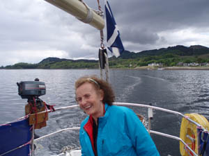
Early afternoon found us rowing out to his vessel: a smart four-berth yacht! This was a totally unexpected treat, and being handed the tiller and photographed, to “prove to the Challenge people that you worked your passage” only enhanced it. The calm weather demanded an engine at first, as we hugged the coast to see Jean waving a farewell flag (saltire, naturally) on the shore at Furnace, but we did raise sail on the main body of the loch. Then, having been dropped by dory on the pontoon at Newton, I made haste along the road to Strachur, whose teashop yielded not only sustenance but a gentleman who was a mine of local geographical information – and which also, rather worryingly, carried a plentiful availability of Avon Skin-so-soft for the midges.
And on the subject of local gentlemen, Jack and his friends were highly intrigued by the Challenge, and he pronounced himself willing to provide a similar service for other Challengers in future. We could do with more starters down there, couldn’t we?

So up to the hills north of Strachur, in the evening sun: rather a lot of cows, stirks, calves and sheep at first, but as dusk approached they disappeared down to the glens, presumably to be fed, and the hillside belonged to me as the rain began!
Day 3
Sunday 13th May – Strachur to Glen Fyne (NN227159)

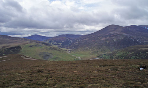
Despite a mild, overcast morning there were blessedly few midges, and as the cloud lifted, the views along this little ridge-walk were amazing. The terrain is peaty, and boggy in places, but alive with red grouse and other birds, and tiny bog-plants; and even in mist navigation is easy as there is a fence, and even bits of path (unless the sheep are regular ridge-baggers too), all the way to the final bealach. There, however, the peatbog becomes more trying and the fence exits stage left; only the last few metres below the summit of Cruach na Capull (the northern one of two hills of that name in the area) were nice springy dry turf and heather. There was also a single, large, gleaming-white marble-like boulder near the summit, unlike any other rock in the area. After racing the oncoming rainclouds to the top, I photographed Inveraray still basking in sun, then the terrain deteriorated again for the rainy cross-country descent: long, slippery grasses shrouding my boots, and concealing tussocks and deep ankle-snapping holes. It took me an hour to reach the road just below, opposite the mapped track to Ardno, which had been visible from the hill.
It seemed reasonable to check with a lady outside the first dwelling that the small road marked by OS on the coast did in fact go through to Ardkinglas and Cairndow. She kindly invited me indoors to enjoy much tea, much chat, and my first call to Challenge Control. She even sampled my “Challenge-special” oatcakes and requested the recipe! Her husband came home: they moved here five years ago after he had been for many years a gamekeeper in Gloucestershire, and they still love it.
The coast track was lush and lovely, with bluebells and hawthorn blossom, and the tangy smell of seaweed. Ardkinglas House appears ancient but was built only about a century ago, and its Pinetum contains, in addition to more types of conifer than I could identify, a brilliant array of rhododendron and azalea, all blooming spectacularly in May, with a yellow variety adding the bonus of sweet and powerful scent. The estate road emerges on to a small road by the picturesque Old Kirk at Kilmorich, then in Caindow there is the attractive Stagecoach Inn, where I ascertained (for future reference) that B&B costs £30-£45, and meals are served all day.


Sadly, I needed to push on a bit farther to maintain my schedule, and I continued up past the brewery into Glen Fyne, where some local children were having a wonderful time on a rope-swing, finally halting by the river just before the road (now tarmac up to the reservoir) swept uphill.
Having seen no other Challengers since Ardrishaig, I was delighted when three hove into view: David with friends Richard and Monica planned to continue, camping nearer the reservoir, and since they aimed to depart by 7 a.m., I admitted regretfully that I probably would next meet them in Montrose.
Day 4
Monday 14th May – Glen Fyne to Gleann a’ Chlachain

A pleasant surprise before nine next day, as I enjoyed the sunshine on a short pause after the rough and intermittent track along the reservoir, to espy the same three figures coming up behind, having had a lie-in after all! We chatted again, and they went ahead (being younger and faster than I, by miles), but we met on their next break and walked over the bealach and down to Beinglas camp site, joining several Challengers including Howard and Doug again, as well as numerous West Highland Way-ers, for lunch. My morning friends then set off straight up the mountain due east, while most of us set off more modestly on the local section of West Highland Way. We split up when the others diverted to Crianlarich to collect parcels; Howard and Doug were then parting company for the middle week as is their wont. As I continued the higher section, I had my first mobile signal in days, and paused to start organising my next mountain trip – great thing, retirement.
Out of the forest at last, cross the road, admire old St.Fillan’s priory and graveyard, on to leave WHW at Auchtertyre, and the sting in the tail for the day was the unremitting uphill road eastwards to the shielings which Howard had identified as a likely camp pitch. The site was indeed lovely, although without many flat patches: we just about found two. I had pitched, and started a brew out of the rain, when I heard a distant yell as Howard approached for a welcome cuppa in the damp dusk.


Day 5
Tuesday 15th May – Gleann a’ Chlachain to Glen Lyon (Nr. Meggernie)

To enjoy Scottish weather, one has to delight in its unpredictability. Evening had been wet and dreich. The night turned wintry, with hoar frost coating everything. The morning was a delight: brilliant sunshine warmed us, as we found our way eased by a good track extending much further than the map suggested, almost to the head of the burn. We were puzzled to see toad spawn, on a 2-ft.high dry rock.
Only near the top did we have to strike out across fairly easy terrain to the Bealach Ghlas Leathaid. Quite soon after, we reached the start of the excellent system of Land Rover tracks in Glen Lochay. Shining mica reflected the sun as we skirted above the glen on a high track to join the (now tarmac) road across via Lochan Leirg nan Lunn to Glen Lyon. Howard had identified a beautiful pitch down near the river, before the main glen. The temptation to join him, settling down in the late afternoon sunshine, almost overcame my resistance, but I really needed to put in another three hours’ walking to keep within hoping distance of my schedule.
At least the tarmac trudge was relieved by the lush green glen scenery, the only adrenaline being provided by walking close to roving herds of cattle in suspicious calf-protecting mood. I decided against the loop road though Gallin to view Meggernie Castle: it was also tarmac, and very low-lying, and at the other end appeared very private, with associated loud barking of dogs. The higher view was much better, and shortly afterwards I found what appeared to be a designated picnic area by a river – probably not intended for camping, but I pitched after 8 p.m. and was gone before 8 a.m., and was careful to leave no trace.


Day 6
Wednesday 16th – May Glen Lyon to Loch Tummel Inn

Thus I reached Bridge of Balgie too early for its small shop; it did, however, have a public telephone – in which a flyer advertised a new Ben Lawers Bunkhouse nearby…hmm, wish I’d known that! It seemed time for a cleaning and de-ponging night indoors, and I used the ‘phone box to ask the Loch Tummel Inn, where I had a parcel waiting, to see if they had space. They had, but were really too expensive; however, when I asked about a rate without breakfast (always a waste of money for me as I can’t eat the cooked version), they took mercy and quoted a much more reasonable rate.

This would get me up almost to schedule, but left a lot of ground to be covered. The local children were making their way to the lovely Glenlyon Primary School – lucky kids, what a place to start one’s education. The spring lambs here were bigger and fatter than those up in the hills. The track up from Innerwick to Lairig Gheallabhaig was pleasantly open, although the other side was at first unpleasantly stony, and then, although the branch down to Carie was pleasant terrain among colourful plants with many young trees, there was a disappointing lack of any open view over Loch Rannoch. Near the main road, I chatted to a lady from the lochside timeshare, walking her dog; she subsequently pulled up beside me in her car, and when the proffered lift was sadly declined insisted on taking my pack the final kilometre into Kinloch Rannoch, to be collected from the Post Taste Café. Thank you, Moira.

The said café proved a distraction, for more than its good coffee: I was able to check my e-mail there. And the delay brought good luck in that a day-walker from a caravan site, whom I had met high up on the hill, called in, and insisted he could easily take my pack along to the Loch Tummel Inn. His name was Ian, and just then his middle name was Angel, as I had 11 miles of main road to bash. I should perhaps add that I had taken advantage of a special offer to buy a new lightweight Challenge pack just before leaving, and although it was excellent in every other respect, the shoulder straps seemed too narrow (or perhaps the one-size frame too long), and were cutting painfully into my clavicles on those long hauls. And long before this stage, I had given up on the intention to explore the little hills south of Strathtummel; the weather wasn’t great, and the discovery that the bridge on my out-of-date map 51, east of Dunalastair Water, is no more, left me no exit strategy.
So, blessing the said Ian all the way, I covered those 11 miles between 5 and 8.10 p.m., arriving very weary and feeling slightly sick, after something over 40 Km. Finding Brian and Eileen Reid already there and expecting me (because of my pack) was a tonic – especially when accompanied by a dram! Then a shower, and a phone-in to Control, and I was ready to eat something very light; the chef – bless him, too – had waited for me, and provided the best plate of scrambled egg I had ever tasted. After clothes-washing and pack-sorting, I fell into a beautiful bed…unfortunately too tired to sleep well. However, I certainly can’t fault the Loch Tummel Inn. The staff were very friendly, and the comfort and service were excellent.
Day 7
Thursday 17th May – Loch Tummel Inn to Glen Tilt (Gilbert’s Bridge)

After that marathon, I needed a shorter day – such as Brian and Eileen had planned. We walked together up to Loch Bhac and on over to Bruar, where the food is excellent though not cheap, and the soup was wonderful. Then the same scenario again: the Reids headed along the B road for a comfortable night in Blair Atholl, while I needed to put in more distance. Why, oh why, had I thought this “as long as possible” route was a good idea??
Forking up through the Castle grounds in light rain, I reached the historic St.Bride’s Church, Old Blair, 16th century but on the site of a much earlier Church. Apparently Angus, son of the Lord of the Isles, had seized the land and imprisoned the owners, but repented during a scary storm as he sailed to Islay, released them and rebuilt the church in 1475. It’s always a peaceful spot for a break, with the added attraction (noted on a previous Challenge) that it receives an excellent mobile phone signal, allowing me to book ahead for the Youth Hostel in Braemar.

Then, feeling weary despite the easy going, I proceeded up Glen Tilt for a short way, relieved to note that the military was not firing on its range just then, and camped shortly after Gilbert’s Bridge. Nearby Auchgobhal disgorged a crowd of teenage boys, presumably on an outdoor holiday, down the track. After some brief sunshine the evening was grey, with Beinn a’Ghlo swathed in cloud. Usually I use my tiny long-wave radio (a real find, thanks to Ian Cotterill) only for early morning weather forecast and news, but now, snuggling down early, I found Radio 4 broadcasting a magnificent service for Ascension Day from St.Giles’,Cripplegate in London, including Haydn’s St.Nicholas Mass as liturgy. Bliss.

Day 8
Friday 18th May – Glen Tilt to Braemar

In the morning I found another Akto had appeared in the night: this turned out to be Chris Barnes of Backpackers’ Club, hiking some hills while his partner and her friend were on the Challenge. I left him before 8, and a few kilometres up, seemingly alone, and therefore none-too-careful when nipping behind a rock, I suddenly had to hurry, finding myself rapidly approached by two other Challengers! These were old-hands Roy (who told me everyone calls him Joe) and Bill – almost as old as I am, and more experienced Challengers. We walked together, occasionally joined by Chris, at first thoroughly enjoyably, but later in ever-deteriorating weather.
We finally forded the Geldie in cold, driving rain and sleet, the wind rising yet more as we passed White Bridge and beyond. Joe and Bill decided against their planned camp at Linn of Dee and accompanied me to Inverey hostel, which was of course full – many other campers had decided similarly. I was very glad I had booked Braemar, even if it meant another late road-trudge; Joe and Bill crossed to Mar Lodge and found shelter there. Delighted by another opportunity to have my pack transported ahead, I enjoyed the walk to Braemar, because of the company – first Andy Desmond, then a friend whom Andy introduced as “Patrick” but who turned out to be Humphrey Weightman! He and I found acquaintances in common, in my husband’s Gaelic world, in which Humphrey provides graphic design for a journal.
We stopped off briefly at the Fife Arms, greeting Dave Beaumont (last seen Ardrishaig) and others, but I moved on at 8.30 to the Youth Hostel, where after a shower and meal I was too lazy to go out in the rain again. Again I didn’t sleep well…forgetting how to sleep in a bed?

Day 9
Saturday 19th May – Braemar to Glen Builg

In the morning I was delighted to meet our senior Challengers, Bernard and Margaret, who after an early night showed much more energy than I could. After a leisurely breakfast and a phone-in, I visited the local outdoor shop and bought a cheap foam sit-mat, which I then cut into strips to attach with duct tape to my shoulder straps for padding. This looked “orra”, but solved my problem for the remainder of the Challenge.
Then onwards and upwards through Invercauld Forest. As in so many such places which are under constant development for leisure walkers, there are far more tracks than on my map, and I foolishly turned up out of the trees slightly too soon. Fortunately, the weather had cleared and the mistake was easily identified and corrected. Higher up, just as a blustery shower began, I came upon an unlocked wooden hut in good condition, for excellent shelter. Then as I considered the option of a smaller footpath, I met a couple – John Mackay, accompanying his Corbett-collecting wife who had almost completed the total. They advised against this footpath; they also passed me Dave Beaumont’s rucksack cover, which they had found near a top, after seeing him unsuccessfully hunting it! They had arranged with the estate to take their car in to a spot near Loch Builg, and I walked with them to it and waved them off. The track along above the shore of Loch Builg, on a golden evening, with dunlin playing on the shore, was one of the loveliest of my walk, and I camped in the sun just by the second ford of the Builg Burn.
Day 10
Sunday 20th May – Glen Builg to Shieling at NJ271129
My OS map suggests two further crossings of the same burn below this, but these were not needed – the path continues on the same side. (The marked bridge crossing the burn to lead up Glen Avon, however, is badly damaged. Two other Challengers had found this, heading in the opposite direction, for Ballater and Tarfside.) At Inchrory, I headed north up the shoulder of Bad a’Ghuail, and on over Creag Vannin and Tolm Buirich. Although mainly rough and pathless, the terrain wasn’t too bad, and for once I decided to listen to some Sunday morning radio on the trail. When it came to the Desert Island Discs choices of Greg Dyke, Bruce Springsteen certainly put a spring in my step!
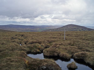
So all was well with the world… until I reached Carn Ealasaid, which despite its lovely name proved a purgatory of peathags, mercifully dry but extending for miles, and huge, so that when I had to descend into some, they were far above my head. To add insult to injury, a band of rain appeared visibly to follow me along the ridge! Those hags were followed by deep heather for a long contour, and it took hours for me to fight my way to the road just below the Lecht ski area. As I crossed over to the hills opposite, I abandoned any hope of a nice dry romp along the tops of the Ladder Hills! (Ian Shiel had warned me I might find it boggy up there…the understatement of the year. Why didn’t I listen?)
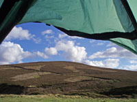
I cut up and over the tussocky heather, seeing lots of red and black grouse and mountain hares (one of which appeared to sit for her portrait), to a building marked on the map as “Shiel”; this wasn’t a bothy, it was locked, but it provided sheltered flat green camping by a burn, with sunlight at last – and hailstones to follow.

Day 11
Monday 21st May – NJ271129 to Rhynie

Some desolate-sounding birdcalls this morning, and some very large birds, too high up for me to see detail against the sun. But a lovely day, and having decided on some land rover tracks instead of the summits, I found them excellent going, weaving up and down the hillsides, ideal for wide-sky, wilderness walking – highly recommended. One little ruin would, with some restoration, make an excellent bothy.
After descending into Glenbuchat and a sunlit lunch, I headed up again, now aiming for the ridge at Creag an Eunah, this being my only possible way of regaining my schedule. From there I braved the peatbogs again over Dun Mount and Mount Meddin, and admired the view of The Buck, the climax and highest peak of the range. But in view of the late hour and the terrain, I decided to pass the Buck today (ouch, sorry, couldn’t resist) and found the LRT leading by Clova Hill down to Lumsden, which I could soon see below, in the early evening sun. From there I turned reluctantly north, abandoning the planned Correen Hills in case of getting benighted there, aiming for Ford of Clatt, where I had a parcel to collect and had provisionally booked B&B. My hostess Lucy, bless her, had said it didn’t matter how late I arrived, but it seemed a bit much to arrive in the dark – especially having walked since 7 a.m.

So I committed the cardinal sin, and accepted a lift for the last two miles into Rhynie, politely declining the offer of transport on to Clatt, because I knew I could make up the extra two miles’ penance next day, but not much more. Thus I staggered up about ten, just as dusk was closing in. Lucy and her daughter Kate (in the midst of A-levels prior to a summer job at Glyndebourne, then a gap year of volunteering overseas) seemed fascinated by the Challenge, and were endlessly kind; again in my state of weariness, I couldn’t face much food and Lucy provided scrambled egg – washed down with good red wine! And then there was a bath…
Day 12
Tuesday 22nd May – Rhynie to Rothienorman


I was now on schedule again (apart from those extra two miles), and felt able to accept Lucy’s kindness and use the morning sunshine to dry off my tent in her garden for a couple of hours, and my washing on her line. Then a late start included walking back up the road to Clatt, walking her dogs Martha and Nutmeg. (I put in the remaining extra mileage by later detours, including one to see a stone circle to which, frustratingly, access was effectively barred once I got close to it.) My legs were protesting today, which made tarmac roads almost a relief – especially when so pretty and so rich in flowers, butterflies and birdsong (even the GOCKOO).
No-one I met was able to tell me why the Cadgers’ Road is so called. There are two quite large churches up the hill there, and I wondered about charity-seekers in the past…but then Google revealed thousands of entries for many Cadger’s Roads, and it seems it may simply be a surname.
It was good to be in the Doric-speaking lands of my childhood, and to hae a claik wi’ a fairmer pittin up a fence, an anither fairmer takin’ doon a fence (not the same fence, honest). Having thought of seeking accommodation at Rothienorman, I was lucky enough to find a good wild-camp site just before it, and slept early, planning an early start.

Day 13
Wednesday 23rd May – Rothienorman to Old Deer
The staff at Vale Hotel, Fyvie, were slightly taken aback at being asked for coffee before 9 a.m., but rose gallantly to the occasion. Again, not enough Challengers head into Buchan; they had never heard of the event, but charge only £30 for B&B, and have a mouth-watering bar-meals menu. They are often busy and have only five rooms, but I was assured that the huge green lawn area beyond the outdoor bar tables could readily be used for camping, and the village Co-op nearby is open 0600-2200! I took time to wander around the outside of the historically-interesting Fyvie Old Church; unfortunately one cannot see the symbol-stones inside without prior arrangement, but there is a very informative history-board, and I was able to view the grave of Mill o’Tifty’s Annie. Of course Fyvie has a castle – the north-east bristles with them.
Many are deterred from heading thus far north by the need to walk on tarmac. But these minor roads can be very pleasant, allowing one to swing along at good pace, enjoying the wide views to the full.

Then there are the “finds” in villages, like the Church Café (of St.Kane’s) in New Deer, open 10-4, with excellent home-cooking and very kind ladies who provided a gallon of tea and charged me for one cup! New Deer also has small shops, a pub and a bank, which can be useful at this stage.
On then to a footpath again, at Maud: the Formartine and Buchan Way, converted from the old Aberdeen to Fraserburgh and Peterhead railway. Nice to have soft earth and grass underfoot again, although like most ex-railways, it’s awfully straight! Interesting to see old Deer Abbey and to wander through Old Deer village. Then, close to where the Way crosses a main road, there is an excellent camping and Caravanning Club campsite in the extensive Aden Country Park (pronounced “Ah”, not “Ay”, apparently), where there are good showers, a laundry and a small shop, and they charge £6.40 for a tent – or £4 if you’re old, like me!

Day 14
Thursday 24th – May Old Deer to Rattray Head
Final Day! And a bit of near-the-end acceleration, with an early start and a lovely sunny breeze, carried me from Longside up along those tiny roads, by Rora, Outhill, Pitbirn, Overside and Bylands (lovely names!) to cross the A90 opposite a hotel. Some overgrown and muddy track led on to the final tarmac stretch past Old Rattray Church – where I might have spent longer had the rain not started in earnest. Seemed appropriate as Challenge-finishing weather, but I kept remembering those four or five kilometres back to the main road afterwards, for the bus.
Then, about 500 metres from what must have been the accommodation-block for lighthouse-keepers, I heard a vehicle approach! This was a delivery van, and since it transpired that the block ahead had become a hostel, the driver assumed I was heading there in the now-driving rain, and offered me a lift. I explained why I could not accept – but how eternally grateful I would be if he could wait long enough to take me back to the road. He muttered about a tight schedule; then, taking pity on my drookit state, agreed to wait by the buildings if I could be back in about ten minutes.
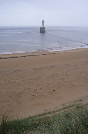
There followed a forced march down to the buildings, a pack-drop by his van, and a sprint finish over huge sand-dunes to the beach and back…now, have you ever tried sprinting in deep soft sand, up and down steep high dunes, in wet heavy boots? Of course this included a hurried, totally non-artistic photograph of the lighthouse – that name familiar to every addict of the Shipping Forecast: Rattray Head.
Puffing, sweating and dripping, I returned in triumph to the van, where the driver fed me tea from his flask, and a muesli bar! Aren’t people wonderful? And he dropped me at the A90 with 10 minutes to spare for the bus, which in turn led to excellent connections in Peterhead and Aberdeen, and time to pitch at the campsite and shower before the night’s festivities.
A fantastic fortnight, as always, and again filled with new places and new experiences. Next year, however, I might just settle for a short and sociable route!